Introduction: The Invisible Superhighways in the Sky
When we picture the forces that shape our planet’s climate and hydrology, our minds often turn to vast, visible features: swirling hurricanes, immense glaciers, or powerful ocean currents. Yet, some of the most dramatic and essential processes occur high above us, hidden from plain sight within the atmosphere itself. One such phenomenon is the Atmospheric River (AR), a concept that has revolutionized meteorology over the last few decades. These are essentially massive, narrow corridors of concentrated moisture vapor that snake across the sky, often spanning thousands of kilometers in length but only hundreds in width. They act as invisible superhighways, transporting staggering volumes of water from tropical and subtropical regions toward the mid-latitudes, impacting weather systems far more profoundly than their appearance suggests.
Though they are often invisible to the naked eye, the amount of water flowing through a single, mature Atmospheric River can be equivalent to the average discharge of the Amazon River, the world’s largest river by volume. When these moisture plumes make landfall, particularly against coastal mountains, they rapidly release their stored water. This release often manifests as periods of intense, sustained precipitation, sometimes lasting for days. The resulting downpour is responsible for nearly all extreme flooding and a majority of the annual water supply in many temperate regions, especially along the western coasts of continents.
Understanding the mechanics, tracking, and predicting the impact of these atmospheric giants is a crucial area of modern climate science and disaster management. As global temperatures rise, the capacity of the atmosphere to hold moisture increases, potentially making these atmospheric rivers even more intense and consequential in the future. This comprehensive guide will explore the fundamental science behind Atmospheric Rivers, detail their formation and lifecycle, examine their dual role as both life-givers (water supply) and destroyers (flooding), and discuss the critical challenges of forecasting these powerful, sky-bound phenomena.
Section 1: The Core Science of Atmospheric Rivers
Atmospheric Rivers are a distinct meteorological phenomenon governed by the principles of atmospheric circulation, moisture transport, and thermodynamics.
A. Defining the Phenomenon
An Atmospheric River is scientifically defined by the intensity of its water vapor transport, not just the presence of moisture.
A. Integrated Water Vapor Transport (IVT): Scientists measure the intensity of an AR using the metric Integrated Water Vapor Transport ($\text{IVT}$). $\text{IVT}$ quantifies the amount of water vapor moving across a vertical column of atmosphere per unit of time.
B. Narrow Filament: An AR is typically a narrow, elongated filament, usually less than 400 to 500 kilometers wide. This narrow focus is what concentrates the massive volume of water into a high-impact corridor.
C. Low-Level Jet: The moisture transport within an AR is often facilitated by a strong, low-altitude wind current known as a low-level jet. This jet stream acts as the conveyor belt, rapidly pushing the moisture poleward.
D. Tropical Origins: Most Atmospheric Rivers originate over warm, tropical or subtropical oceans, where high surface temperatures allow for massive evaporation and atmospheric moisture loading.
B. The Thermodynamics of Transport
The sheer volume of water carried by an AR is explained by the fundamental thermodynamic relationship between heat and moisture capacity.
A. Clausius-Clapeyron Relationship: This principle states that for every $1^\circ \text{C}$ rise in temperature, the atmosphere’s capacity to hold water vapor increases by approximately $7\%$. Warmer air in the tropics naturally holds vastly more moisture.
B. Vapor Concentration: Because ARs tap into this highly concentrated tropical moisture reservoir and transport it rapidly toward colder mid-latitudes, they move maximum possible moisture content in a short time.
C. Latent Heat Release: When the water vapor in an AR condenses into liquid (rain or snow), it releases a tremendous amount of latent heat back into the atmosphere. This release further strengthens the storm and sustains the precipitation process.
D. Equator-to-Pole Energy Balance: ARs play a crucial, non-linear role in the Earth’s large-scale energy balance. By moving warm, moist air from the tropics toward the poles, they help redistribute heat globally, which is essential for climate stability.
Section 2: The Lifecycle of an Atmospheric River
Atmospheric Rivers typically follow a predictable lifecycle of formation, transportation, and eventual dissipation, governed by large-scale weather systems.
A. Formation and Development
ARs usually form on the warm, unstable side of large weather systems, often associated with a particular type of mid-latitude storm.
A. Warm Conveyor Belt: An AR often develops along the warm conveyor belt—a stream of warm, moist air ahead of the cold front of an extra-tropical cyclone (a mid-latitude storm).
B. Anticyclonic Influence: The initial focus and narrowness of the moisture flow are often shaped and maintained by a high-pressure system (anticyclone) positioned near the coast, which helps steer the moisture stream toward the shore.
C. Fueling Extratropical Cyclones: Once formed, the AR acts as a vital fuel source for the developing extra-tropical cyclone. The massive latent heat release from the condensing vapor provides energy that intensifies the storm system.
B. Landfall and Impact
The most critical stage of an AR is its interaction with land, particularly mountainous terrain, which forces the moisture to condense rapidly.
A. Orographic Lifting: When the moist, low-level jet encounters coastal mountains (like the Sierra Nevada or the Cascades), the air is forced upward. This process, called orographic lifting, cools the air quickly.
B. Rapid Condensation: As the air cools, its moisture-holding capacity plummets, causing rapid and widespread condensation and intense, heavy precipitation (rain or snow) on the windward side of the mountain range.
C. Pineapple Express: The most historically famous type of AR is the “Pineapple Express,” which specifically transports moisture from the vicinity of Hawaii toward the west coast of North America, bringing much-needed but sometimes excessive rainfall.
D. Runoff and Flooding: The massive, sustained precipitation rates overwhelm river systems and urban drainage, leading directly to catastrophic flooding, landslides, and widespread infrastructure damage.
Section 3: The Dual Nature: Benefit and Hazard
Atmospheric Rivers present a classic meteorological paradox: they are both essential sources of freshwater and the primary driver of flood disasters in many regions.
A. Life-Giving Water Supply
In arid and semi-arid regions, Atmospheric Rivers are crucial for sustaining long-term water resources and mitigating drought.
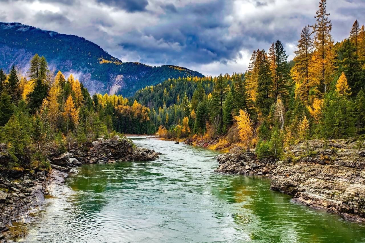
A. Annual Snowpack: ARs are responsible for creating the deep, high-elevation snowpack in mountain ranges, particularly in western North America and the European Alps. This snowpack acts as a natural water reservoir.
B. Seasonal Runoff: The slow melting of the snowpack during the spring and summer provides essential seasonal runoffthat recharges reservoirs, supports agriculture, and sustains ecosystems through the dry season.
C. Drought Breaking: A sequence of strong, well-timed ARs is often required to officially break severe droughtconditions, replenishing soil moisture and filling major water storage facilities.
D. Water Resource Dependency: In California, for example, a few Atmospheric River events each winter can account for half of the state’s total annual precipitation, underscoring the regional dependence on these systems.
B. Hazard and Economic Damage
When ARs arrive with excessive intensity or frequency, their impact shifts dramatically from beneficial to destructive.
A. Flood Intensity: The most destructive flood events in coastal regions are almost always directly attributable to the landfall of one or more successive strong Atmospheric Rivers.
B. Landslide Risk: Prolonged, heavy saturation of soil, especially on steep slopes, dramatically increases the risk of landslides and mudslides, leading to loss of life and isolating communities.
C. Economic Disruption: A single, intense AR event can cause billions of dollars in damage to public infrastructure, agriculture, and private property, leading to massive economic disruption.
D. AR Scale Index (AR Scale): To communicate the potential hazard, scientists developed the AR Scale, ranging from AR 1 (Beneficial) to AR 5 (Exceptional, primarily hazardous). This is analogous to the Saffir-Simpson Hurricane Wind Scale.
Section 4: Forecasting and Modeling Challenges
Predicting the exact landfall and intensity of Atmospheric Rivers is complex, requiring sophisticated modeling and significant computational resources.
A. Modeling the Moisture Pathway
Accurately simulating the formation and trajectory of an AR relies on advanced global weather models.
A. Numerical Weather Prediction (NWP): AR forecasts are generated using Numerical Weather Prediction (NWP)models. These models solve complex mathematical equations that describe atmospheric physics and dynamics across a three-dimensional grid.
B. Boundary Layer Physics: The accurate simulation of the atmospheric boundary layer (the layer near the surface) is particularly critical. This layer controls the rate of evaporation and the friction that steers the low-level jet.
C. Data Assimilation: Models rely heavily on data assimilation—feeding real-time satellite, buoy, and land-based observations into the model to refine the starting conditions and improve the short-term forecast accuracy.
D. Predictability Horizon: While large-scale AR formation can often be predicted days in advance, the exact landfall location and the precise quantity of precipitation remain highly challenging to forecast reliably more than three days out.
B. Remote Sensing and Monitoring
Direct observation of the moisture content in the atmosphere is essential for real-time tracking and model validation.
A. Satellite Sensors: Satellites use microwave sensors to measure the total amount of water vapor in the entire atmospheric column over the ocean. This allows scientists to visually track the entire filament of an AR as it approaches land.
B. Aircraft Reconnaissance: In high-stakes situations, specialized aircraft are flown into the AR corridor. They drop dropsondes (instrument packages) that measure temperature, wind, and humidity profiles, providing invaluable data for real-time model initialization.
C. Ground-Based GPS: Networks of ground-based Global Positioning System (GPS) receivers can measure the tiny delay in satellite signals caused by atmospheric water vapor. This provides continuous, high-precision measurement of $\text{IVT}$ over land.
D. Hydrological Modeling: Once an AR is forecast to hit, specialized hydrological models are run. These models take the forecast precipitation as input and simulate the resulting runoff, river levels, and inundation extent to prepare local communities.
Section 5: Atmospheric Rivers in a Warming Climate
The relationship between Atmospheric Rivers and climate change is one of the most critical areas of current research, suggesting significant changes are ahead.
A. Increased Intensity and Frequency
As the planet warms, the underlying thermodynamic principles dictate a likely intensification of Atmospheric Rivers.
A. Higher Moisture Loading: The $7\%$ increase in moisture capacity per degree of warming, governed by the Clausius-Clapeyron relationship, means that future ARs will carry significantly more water vapor than those in the past.
B. More Extreme Rainfall: Since the amount of precipitation is directly related to the amount of vapor transported, this higher moisture loading is projected to result in a greater number of ARs reaching the hazardous categories (AR 4 and AR 5), driving more extreme rainfall events.
C. Poleward Shift: Climate models also suggest a poleward shift in the tracks of many mid-latitude storms and ARs. This could increase precipitation in currently dry northern regions but decrease it in already drought-prone southern regions.
D. Flash Droughts: Conversely, warming also intensifies evaporation. While ARs bring flooding, the increasing intervals between AR events, combined with higher temperatures, could lead to more frequent and intense flash droughts in the interim.
B. The Need for Adaptation
Understanding the changing character of ARs is essential for developing robust infrastructure and effective water management strategies for the future.
A. Infrastructure Resilience: Civil engineers must design infrastructure (dams, bridges, and flood defenses) to withstand the higher flood peaks projected for future, more intense ARs, requiring massive investment in climate resilience.
B. Forecast-Informed Reservoir Operations (FIRO): This novel strategy uses accurate, real-time AR forecasts to adjust reservoir levels proactively. Instead of sticking to rigid rules, $\text{FIRO}$ allows water managers to release water ahead of a benign forecast and retain it ahead of a dry forecast, maximizing both flood control and water storage.
C. Early Warning Systems: Improved $\text{IVT}$ tracking and the use of the AR Scale are enhancing early warning systems, giving communities more time to prepare for severe flooding and evacuate effectively.
D. Cross-Disciplinary Research: The future of AR management requires close collaboration between atmospheric scientists, hydrologists, engineers, and water managers to translate complex climate projections into actionable, local policy.
Conclusion: Mastering the Sky Rivers
Atmospheric Rivers are spectacular, powerful phenomena that fundamentally shape the hydrology, ecology, and societal well-being of the mid-latitudes. They are a force of nature that we are only now truly beginning to quantify and understand.
Atmospheric Rivers are vast, narrow filaments of concentrated moisture that transport volumes of water equivalent to the world’s largest rivers.
Their intensity is measured by Integrated Water Vapor Transport ($\text{IVT}$), quantifying the massive moisture flow in the atmosphere.
The extreme moisture content is explained by the Clausius-Clapeyron relationship, where warmer air holds significantly more water vapor.
ARs are formed by the low-level jet on the warm side of extra-tropical cyclones, drawing moisture from the tropics.
Landfall against coastal mountains causes orographic lifting, forcing condensation and generating intense, sustained precipitation.
They have a dual nature, acting as the primary mechanism for breaking droughts and creating essential mountain snowpack reservoirs.
Conversely, intense ARs are the leading cause of major flooding and catastrophic landslides in many temperate coastal regions.
Forecasting relies on complex Numerical Weather Prediction (NWP) models and real-time monitoring via satellite microwave sensors and aircraft dropsondes.
Climate change is projected to make ARs more intense due to higher atmospheric moisture loading, increasing the severity of future floods.
Effective management requires adaptation, including advanced strategies like Forecast-Informed Reservoir Operations ($\text{FIRO}$) to balance water storage and flood risk.